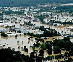
Are you happy to be at Flood Risk?

The Logan City Council has been required by the Queensland State Government to prepare a “ Flood Risk Map” for all properties within its jurisdiction. Council has prepared a “Flood Risk Map” and has released it for public consultation.
The mapping places properties in a “High Risk” band, a ”Medium Risk” band, a ”Low Risk” band or a “No Risk” band.
Some residents own property which has never ever flooded, in the Medium Risk or the Low Risk bands.
If this is you are you happy for your land to be designated at risk of flooding in the Council records?
1 Do you accept the accuracy of the mapping?
2 Do you consider a 1 in 100 chance of inundation in a flood as a significant risk?
If you said “No” to either question you should make your view known now.
Take the following steps:
(a) Complete the FORM: Submission (Logan Plan) available from Logan City Council and lodge it with Council.
(b) Attend the consultation with planning officers on Thursday October 9th in Room 1 at the Beenleigh Library between 1:30pm and 4:30pm and tell them.